

.jpg)


Holy
Pilgrimage – Temples in Uttarakhand
State
Panch Prayag
Several rivers in the Garhwal region merge with the Alaknanda at Panch Prayag or 'holy confluence of rivers'. These are:
1. Vishnuprayag,
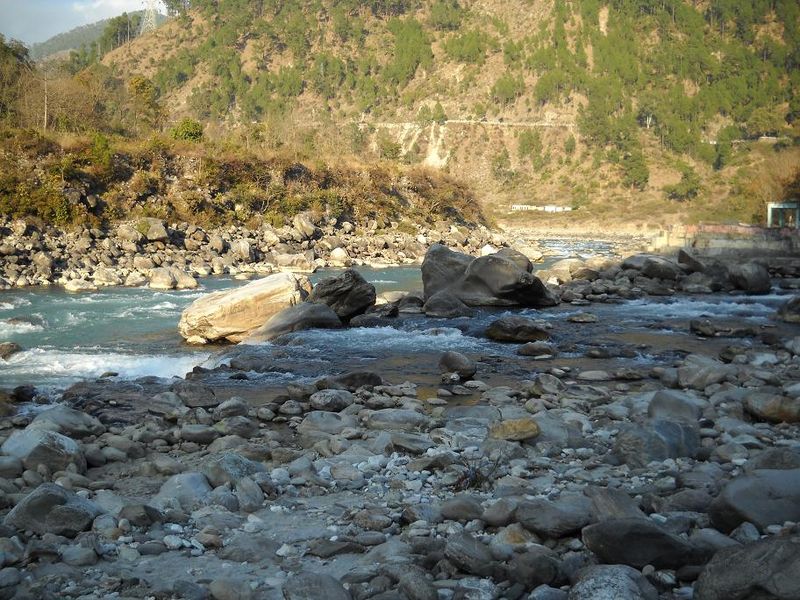
where the Alaknanda is met by the Dhauliganga River
2. Nandaprayag,
where it is met by the Nandakini River
3. Karnaprayag,
where it is met by the Pindar River
4. Rudraprayag,
where it is met by the Mandakini River
5. Devprayag,
where it meets the Bhagirathi River and officially becomes the Ganges
Dams
There are 37 hydroelectric dams in operation, under construction or planned to block the flow of the Alaknanda river and its tributaries and generate electricityTowns along Alaknanda River
As the river flows, the towns along its banks are Badrinath, Vishnuprayag, Joshimath, Chamoli, Nandaprayag, Karnaprayag, Rudraprayag, Srinagar and Devprayag. At each town with suffix prayag, Alaknanda meets another river.Panch Prayag
Panch Prayag (Sanskrit: पंच-प्रयाग) is an expression in Hindu religious ethos, specifically used to connote the five sacred river confluences in the Garhwal Himalayas in the state of Uttarakhand, India. The five prayags - prayag meaning "confluence" in Sanskrit - also termed as “Prayag pentad”, namely the five river confluences, are Vishnu Prayag, Nand Prayag, Karn prayag, Rudra Prayag and Dev Prayag, in the descending flow sequence of their occurrence.
Path
It starts with the Vishnu Prayag on the Alaknanda River, which is one of the two source streams of the sacred river Ganges in the Garhwal Himalayas; the other streams are the Dhauliganga, Mandakini, Pindar and the Bhagirathi - the head stream of the Ganges.Alaknanda descending from the foot of the Satopanth (a triangular lake, which is located at a height of 4,402 m (14,442.3 ft), above the sea level and named after the Hindu trinity: Brahma, Vishnu, Shiva and Bhagirath Kharak glaciers near the Nanda Devi peak, in Uttarakhand cascades over a length of 229 km (142.3 mi) encompassing the five prayags and is joined at Dev Prayag by the Bhagirathi, a shorter river source vis-à-vis Alaknanda to form the main stream of the Ganges. It flows down south towards Rishikesh and Haridwar, two holy places on the bank of the Ganges in Uttarakhand.
At each of the confluences, with large influx of pilgrims who visit the state for the pilgrimage of the Panch Kedar and Sapta Badri temples, large religious towns have developed. Pilgrims take a dip in the river at these locations before embarking on visiting the holy shrines in the “Deva Bhumi” (god's land) as Uttarakhand is commonly known. The religious towns are named after the confluence sites as: Devaprayag, Nandprayag, Karnaprayag, Rudraprayag, except Vishnuprayag, where there is no town but it is about 12 km (7.5 mi) from Joshimath town another famous Hindu religious centre), along a winding road that further leads to Badrinath Temple and beyond. Some pilgrims do ablution at all the five prayags before worshiping Vishnu at Badrinath.
Meaning
Prayag in Hindu tradition signifies confluence of two or more rivers where ablutions (bathing) before worship, religious rites called the Shraddha (the last rites) for the departed and worship of the river itself as manifestation of God are a prevalent practice. While the Prayag at Allahabad, where the three rivers namely, the Ganges, the Yamuna and the Saraswati confluence, is considered the holiest, the Panch Prayag of Garhwal Himalayas are the next in the order of piety. The Prayags are rich not only in mythological folk lore and legend but also in scenic beauty of the Himalayan snow covered peaks and enchanting valleys. It is also deduced that the Panch Prayag located on the road to Badrinath refer to the Svargarohana (ascend to heaven) route followed by the Pandavas to attain salvation after they completed circumambulation of the earthVishnuprayag (of Panch Prayag)
Vishnuprayag is one of the Panch Prayag (five confluences) of Alaknanda River, and lies at the confluence of Alaknanda River and Dhauliganga River on the Joshimath-Badrinath route, in Chamoli district in the Indian state of Uttarakhand. According to mythology, it is the place where Sage Narada meditated, after which Lord Vishnu appeared before him. Kagbhusandi Lake, with its emerald green water, is a nearby attraction.
Geography
Its geographical coordinates 30.34°N 79.34°E and its original name (with diacritics) is Vishnuprayāg. It has an average elevation of 1,372 metres.How to Reach
- Rail: Closest railway station from Vishnuprayag is Rishikesh at a distance of 263 km (163.4 mi) away. Buses and taxis are easily available from Rishikesh to Vishnuprayag.
- Road: Vishnuprayag is at a distance of 504 km (313.2 mi) from Delhi, 263 km (163.4 mi) from Rishikesh and 283 km (175.8 mi) from Nainital. Vishnuprayag is connected by roads from major towns and cities of Uttarakhand like Karnaprayag, Srinagar, Rishikesh, Haridwar, Nainital etc.
- Air: Jolly Grant Airport is the nearest airport to Rishikesh situated 283 km (175.8 mi) from Vishnuprayag
Best time to Visit
Can be visited throughout the year but best to avoid monsoon months. Due to probalities of land slides and road blockages, even though the place offers some great scenic beauty.
Path
The Alaknanda River, which originates in the eastern slopes of glacier fields of Chaukhamba, is joined by the Saraswathi River near Mana (that originates on the south from the international border), and then flows in front of the Badrinath temple, one of the most revered Hindu shrines. It then meets the Dhauli Ganga River, whose origin is from the Niti[disambiguation needed] Pass, after traveling a distance of 25 km (15.5 mi) from its source to form the Vishnu Prayag. This stretch of the Alaknanda River is called the Vishnu Ganga. Legend narrates the worship offered by sage Narada to god Vishnu at this confluence. An octagonal shaped temple - located near the confluence - dated to 1889, is credited to Maharani of Indore - Ahalyabai. Though originally built to install a Shiva linga, it now houses a Vishnu image. A stairway from this temple leads to the Vishnu kund (kund means pool of water or lake) at the confluence, which is seen in a tranquil state.Places Nearby
Vishnuprayag Hydro Electricity Project
This project is owned by Jaypee Industries and is around 12 km in length. The project is capable of producing 400MW. Mutual understanding has been done between the government and Jaypee industries regarding consumption of energy and selling it. The project is located at Hanuman Chatti near Vishnuprayag.Badrinath Temple
Badrinath is set at an altitude of 3,133mts above sea level in the Chamoli district of Garhwal region in Uttarakhand state. The deity of Badrinath temple is Lord Vishnu and the temple was established in the 9th century by Adi Shankaracharya. The temple has a height of approximately 15mts with the top covered with a gold gilt roof. The temple is situated on the right bank of the sacred Alaknanda River with the colorful ‘Singh-Dwara’ at the entrance. The temple stays closed during winter as the place is prone to heavy snowfall.Auli
Auli is situated 29 km from Vishnuprayag. Popular for Skiing and Paragliding, this tourist destination offers amazing views of the snow clad peaks of the majestic Himalayan range. Asia’s longest and highest cable car is situated in Auli connecting it with Joshimath.Valley of Flowers National Park
Valley of Flowers National Park can be reached by a trek of 16 km from Govind Ghat. It is nestled in the west Himalayas covering an area of 87.50sq km. The valley is entirely covered with the sheets of snow during winters and the flowers bloom here from June to October only. This place is rich in varied and unique flora and fauna. Valley of flowers national park is the home of many endangered animals like brown bear, black Asiatic bear, blue sheep and snow leopard. The valley of flowers was declared as the national park in the year 1982 and it is now a world heritage site. The valley of flowers is situated in the Chamoli district of Uttarakhand state. The virgin beauty of this valley lures the botanists, nature lovers and adventure lovers.Chopta
Popularly known as Mini Switzerland or the Switzerland of India. The number of tourists visiting Chopta has increased in recent years. Tungnath the highest temple of Lord Shiva is only 3.5 km away from here which should be covered on foot. Chopta is situated 117 km from Vishnuprayag.Hanuman Chatti
Situated few kilometers ahead of Vishnuprayag where a temple is dedicated to God Hanuman. This was the place where Hanuman and great Bheema of Mahabarata met. God Hanuman disguised as an old monkey to test the strength of Bheema.Kagbhushandi Lake
It is situated near Vishnuprayag and the emerald water of this pristine lake affords enchanting views. The lake can also be approached from Vishnuprayag beside from Bhundhar village near Ghangaria.Nandaprayag (of Panch Prayag)
Nandaprayag is a town and a nagar panchayat in Chamoli district in the Indian state of Uttarakhand. Nandaprayag is one of the Panch Prayag (five confluences) of Alaknanda River, and lies at the confluence of Alaknanda River and Nandakini River.
Karnaprayag (of Panch Prayag)
Karanprayag is a city and municipal board in Chamoli District in the Indian state of Uttarakhand. Karanprayag is one of the Panch Prayag (five confluences) of Alaknanda River, situated at the confluence of the Alaknanda, and Pindar River.
Overview
Karan Prayag is one of five sites where the confluence of rivers occurs. The five prayags are Vishnuprayag, Nandprayag, Karanprayag, Rudraprayag and Devprayag. Allahabad where the Ganges, Yamuna and mythical Saraswati join, is known as Prayag, and is one of the holy places of Hindu pilgrimage. Karanprayag is believed by many to be the place where Karna of the Mahabharata, was to have worshipped the Sun God. It is the ancient temple, devoted to Uma and Karna.It is on the way to Badrinath, on the confluence of two holy rivers Alaknanda and Pindar. It is said that Karna of Mahabharata meditated here for many years to acquire the impregnable shield, which made him a formidable warrior in the battlefield. Swami Vivekananda meditated here for eighteen days with his Guru Bhai, Guru Turianand ji and Akharanand ji. It is the sub-divisional head-quarter of district Chamoli. Roads from here go to Almora, Nainital and Jim Corbett National Park.
How to reach
Air
The nearest airport is the Jolly Grant Airport near Dehradun 213 km (132 mi) away.Railway
The nearest railway station is at Rishikesh. However, Rishikesh is a small railway station not connected by fast trains. Haridwar railway junction, 24 km farther from Rishikesh, has train connections to most of the major cities in India and is, therefore, the railhead for Karnaprayag.Road
Karnaprayag lies on national highway NH58 that connects Delhi with Badrinath and Mana Pass in Uttarakhand near Indo-Tibet border. Therefore all the buses and vehicles that carry pilgrims from New Delhi to Badrinath via Haridwar and Rishikesh in pilgrim season of summer months pass through Karnaprayag on the way to Joshimath and further north. Rishikesh is the major starting point for road journey to Karnaprayag and regular buses operate from Rishikesh bus station to Karnaprayag. The road distance from Rishikesh to Karnaprayag is 172 km (107 mi) via Rudraprayag and Srinagar (Uttarakhand).- Haridwar to Rishikesh 24 km
- Rishikesh to Devprayag 74 km
- Devprayag to Srinagar 34 km
- Srinagar to Rudraprayag 33 km
- Rudraprayag to Karnaprayag 31 km
Rudraprayag (of Panch Prayag)
Rudraprayag is a town and a municipality in Rudraprayag district in the Indian state of Uttarakhand. Rudraprayag is one of the Panch Prayag (five confluences) of Alaknanda River, the point of confluence of rivers Alaknanda and Mandakini. Alaknanda then proceeds towards Devaprayag where it joins with Bhagirathi river to form the river Ganges. Kedarnath, a Hindu holy town is located 86 km from Rudraprayag.Rudraprayag is also known for its infamous man-eating leopard (Leopard of Rudraprayag) which is reputed to have killed over 125 people, hunted by Jim Corbett.
How to reach
Air
The nearest airport is the Jolly Grant Airport near Dehradun 183 km (114 mi) away.Railway
The nearest railway station is at Rishikesh. However, Rishikesh is a small railway station not connected by fast trains. Haridwar railway junction, 24 km farther from Rishikesh, has train connections to most of the major cities in India and is, therefore, the railhead for Rudraprayag.Road
Rudraprayag lies on national highway NH58 that connects Delhi with Badrinath and Mana Pass in Uttarakhand near Indo-Tibet border. Therefore all the buses and vehicles that carry pilgrims from New Delhi to Badrinath via Haridwar and Rishikesh in pilgrim season of summer months pass through Rudraprayag on the way to Joshimath and further north. Rishikesh is the major starting point for road journey to Rudraprayag and regular buses operate from Rishikesh bus station to Rudraprayag. The road distance from Rishikesh to Rudraprayag is 141 km (88 mi) via Devprayag and Srinagar.- Haridwar to Rishikesh 24 km
- Rishikesh to Devprayag 74 km
- Devprayag to Srinagar 34 km
- Srinagar to Rudraprayag 33 km
Temples
Rudranath Temple Rudraprayag is named after Lord Shiva and temple of lord Rudranath is situated at the confluence of Alaknanda and Mandakini. According to mythology Narad Muni worshiped god Shiva here to learn music from him. The god then taught him music in his form of Rudra (Lord of Music). There is a rock where it is said that Narad Muni did his worship. It is now known as Narad Shila.Chamunda Devi Temple Chamunda Devi temple is also situated at confluence of the holy rivers ( Alaknanda & Mandakini). Chamunda as wife of Lord Rudra is worshiped here.
Koteshwar Koti means crore (10 Million) and Ishwar means god. This is again a temple of Lord Shiva made in natural caves.
Shree Tungeshwar Mahadev Ji, Phalasi (फलासी) Near Chopta This temple has been here for centuries. Folklore has it that the Pandavas came here for penance. On the way from Chopta there were many small temples up to the Tunganath Temple, the remains of some are still there. On the temple wall there are many terracota style seals and Shiva-Parvati figurines. A very ancient temple held in very high esteem by many villages, right in the midst of amazing n spell-bounding natural beauty.
Kartik Swami The Kartik Swami temple is dedicated to lord Kartikeya - son of Lord Shiva. It can be reached by a 3 km trek from Kanak Chauri village, which is located on the Rudraprayag-Pokhri route, 38 km from Rudraprayag. You can have a magnificent views of the snow-clad Himalayan range from the Kartik Swami temple.
Basukedar Basukedar (reputedly where Shiva lived before coming to Kedarnath).It's a Shiva temple constructed by Pandava. Architecture and idols seems to be at least 1000 yrs old. A good place for meditation and dhyan yoga. This is around 35km from Agustmuni. around 1.30 hr by drive. This is actually an old track to visit Kedarnath. It is said that Lord Shiva stayed a night in Basukedar while he was travelling to Mount Kailash ( Kedarnath) this is the reason this place is called Basukedar
Devprayag (of Panch Prayag)
Devprayag (Devaprayāg) (Devanagari: देव प्रयाग) is a town and a nagar panchayat (municipality) in Tehri Garhwal district in the state of Uttarakhand, India, and is one of the Panch Prayag (five confluences) of Alaknanda River where Alaknanda and Bhagirathi rivers meet and take the name Ganga or Ganges River.
Overview
Traditionally, it is considered to be the place where sage Devasharma led his ascetic life, giving birth its present name, Devprayag. It is one of the five sacred confluences in the hills and is an important place of pilgrimage for devout Hindus.[3]"Devaprayaga" means "Godly Confluence" in Sanskrit. As per Hindu scriptures, Devaprayaga is the sacred event of merging two heavenly rivers, Alakananda and Bhagirathi, to form the holy Ganges.
On a terrace in the upper part of the village is the temple of Raghunathji, built of huge stones, pyramidal in form and capped by a white cupola.
Devprayag is the home of the late Acharya Shri Pt. Chakradhar Joshi (a scholar in Astronomy and Astrology) who established Nakshatra Vedh Shala (an observatory) in the year 1946. This is located on a mountain called Dashrathanchal at Devprayag. The observatory is well equipped with two telescopes and many books to support research in astronomy. It also contains about 3000 manuscripts from 1677 AD onwards collected from various parts of country. Apart from the latest equipment, it also has the ancient equipment like Surya Ghati, Jal Ghati and Dhruv Ghati which showcase the pride of Bharatiya progress in the field of astronomy. Shri Dr. Prabhakar Joshi and Acharya Shri Bhaskar Joshi (Popularly known as Guruji) are currently in charge and caretakers of the observatory.
Devprayag is full of natural beauty. Other than Sangam and Raghunath Ji Temple in Devprayag, one can visit sacred places like Mata Bhuvneshwari temple at nearby village Pundal followed by Dhaneshwar Mahadev temple, Danda Naggaraja (Lord of Snakes) temple and Chandrabadni temple.
Geography
The Alaknanda rises at the confluence and feet of the Satopanth and Bhagirath Kharak glaciers in Uttarakhand near the border with Tibet. The headwaters of the Bhagirathi are formed at Gaumukh, at the foot of the Gangotri glacier and Khatling glaciers in the Garhwal Himalaya. These two sacred rivers join to form the Ganges (Ganga) in Devprayag.Devprayag is 70 km from Rishikesh. Devprayag has an average elevation of 830 metres (2,723 feet).
How to reach
Air
The nearest airport is the Jolly Grant Airport near Dehradun 116 km (72 mi) away.Railway
The nearest railway stations is at Rishikesh. However, Rishikesh is a small railway station not connected by fast trains. Haridwar railway junction, 24 km farther from Rishikesh, has train connections to most of the major cities in India and is, therefore, the railhead for Devprayag.Road
Devprayag lies on national highway NH58 that connects Delhi with Badrinath and Mana Pass in Uttarakhand near Indo-Tibet border. Therefore all the buses and vehicles that carry pilgrims from New Delhi to Badrinath via Haridwar and Rishikesh in pilgrim season of summer months pass through Devprayag on the way to Joshimath and further north. Rishikesh is the major starting point for road journey to Devprayag and regular buses operate from Rishikesh bus station to Devprayag. The road distance from Rishikesh to Devprayag is 74 km (46 mi).- Haridwar to Rishikesh 24 km
- Rishikesh to Devprayag 74 km
- Devprayag to Srinagar 34 km
- Srinagar to Rudraprayag 33 km
PANCH KEDAR
Lord Shiva eluded the Pandavas repeatedly and on being detected by them assumed the form of a bull. The second Pandavas Bhima tried to pick him up, but Shiva sank into the earth and only the hump came in Bhimas's hand. Seeing their determination the lord was so pleased that he freed the Pandavas from their sin and asked them to worship his hump at Kedarnath which is the heights among the twelve Jyotirlingas. The other parts of Shiva's body, arms, face, nevel and hair locks appeared at Tungnath, Rudranath, Madmaheswar and Kalpeshwar. These four shrines along with Shri Kedarnathji are worshipped as "Panch Kedar". The Panch Kedar are the holy destination for all the Hindus. Five Kedars are:
Kedarnath
Tungnath
Rudranath
Madmaheswar
Kalpeshwar
Kedarnath
Kedar is also another name for lord Shiva - the protector and the destroyer.
There are 200 ancient shrines dedicated to Lord Shiva in Chamoli district
itself, the most important is Kedarnath. Shrine of Kedarnath lying at the
altitude of 3584 Mts. on the head of river Mandakini is amongst the holiest
pilgrimages for the Hindus.
The origin of revered temple can be found in great epic Mahabharat. After the
wars, the Pandavas lost their peace of mind after committing the great sin of
slaying their Guru and brothers and sought the blessings of Lord Shiva for
redemption. Lord Shiva avoided them repeatedly and while fleeing took refuge at
Kedarnath in the form of bull. On being followed, He dived into the ground,
leaving behind His hump on the surface. The hump is worshipped in the temple of
Kedarnath in the conical Shiva pinda form. The remaining portions of Lord Shiva
are worshipped at other places.
PLACES-TO-SEE
Shankaracharya Samadhi
The Samadhi of Adi Guru Shankaracharya is located just behind the Kedarnath temple. It is said that after establishing four sacred Dhams in India, he went into his samadhi at an early age of 32 years.
A small lake from where Yudhishthir, the eldest of the Pandavas, is said to have departed to heaven. A 2 km trek from Kedarnath. The floating ice on the crystal clear waters of the lake is a fascinating sight.
14 km. The trekking base to Kedarnath and the road head, this village has a temple dedicated to Gauri and also thermal springs of medicinal value.
6 km. At 4135 mtr. above sea level, this lake is extraordinary, surrounded by high mountains and offering an excellent view of the Chaukhamba peaks.
The confluence of Son Ganga and Mandakini rivers. Road to Triyuginarayan diverts (14 km) from here.
25 km. The mythological venue where the wedding of Lord Shiva and Parvati was solemnized. It is a short trek of 5 km from Son Prayag. An eternal flame, which is said to have been the witness to the marriage, burns in front of the temple even today.
Guptaksahi has a great importance quite like that of Kashi. The ancient Vishwanath temple, Ardnareswar temple and Manikarnik Kund, where the two streams of Ganga and Yamuna are believed for their redemption. Lord Shiv was not willing and so eluded the Pandavas repeatedly. He took refuge at Kedarnath in the form of a bull. Being followed by Pandavas, he dived into the ground leaving his hump on the surface. The remaining portions of God reappeared at four other places. The arms appeared at Tungnath, the face at Rudranath, the stomach (nabhi) at Madmaheshwar and the locks with the head at Kalepeshwar. They are all worshipped there as manifestations of Lord Shiva.
2 kms from the temple is situated Gandhi Sarovar where the ashes of Mahatma Gandhi were immersed. 12 kms from here is the place from where river Mankdakini originates.
Vasukital, yet another beautiful lake is situated at a distance of 8 kms from Kedarnath. Floating ice on crystal clear water fascinates visitors to this lake.
60 km. Winter home of the deity at Kedarnath temple and the seat of the Rawal of Kedarnath. Connected by bus services to Rudraprayag and other major centres.
18 kms form Rudraprayag, at an altitude of 1000 mts and on the bank of river Mandakini, this is the place where Rishi Agastya meditated for years.
For food and accommodation, a Forest Rest House and private hotels are available. Other facilities include market, bank, hospitals and telephone etc.
Situated on the Gopeshwar Ukhimath road about 40 km from Gopeshwar at an altitude of about 2500 mtrs above sea level, Chopta is one of the most picturesque spots in the Garhwal region. It provides a breathtaking view of Himalayan ranges surrounding it. Deoria Tal At an altitude of 2,440 mt, is beautiful lake a situated on the Chopta - Ukhimath motor road. In the early morning, the snow-capped peaks are clearly reflected on the lake waters. This lake also provides an excellent venue for angling, as well as birdwatching.
This is an outstanding massif formed by the three major mountains - Kedar dome, Bharatekuntha at 6578 Meters, is connected to Kedarnath to the East, by a long and dangerous avalanche ridden ridge. At 6000 meters it looks stunning and has several glacial flows, one of which is the Mandakini glacier running down its ridges.
Kedarnath and Kedardome, are connected by a deep ridge. Kedar dome at 6831 Meters presents a fair challenge to climbers. Kedarnath is however, a difficult peak to climb. At 6940 Meters it is just beneath the level where the oxygen layer is thin. Anyone interested in a good day trek, could take the well travelled path from behind the temple toward Bharatekuntha. About three kilometers away in the valley formed by the Kedarnath massif, is Chorabhari Tal. This lake has been renamed Gandhi Sarovar after the Mahatma's ashes were immersed in lake.
Situated at 6000 ft. Kalimath is the famous pilgrimage place of Garhwal. This temple belongs to Maa Kali. Dhaval river flows besides the temple.
Sari village is the last bus terminus on Chopta - Ukhimath road from where a 2 km trek leads to Deoria Tal. This is a beautiful lake at an attitude of 2,438 mts. gives the spectracular reflection of show capped peaks in the lake water Ideal spot for angling and bird watching
Tungnath
The arm of Lord Shiva came out at this place as per Kedarnath myth. The
Tungnath temple is situated at an altitude of about 3680 m above sea level, the
temple is dedicated to Lord Shiva and is the highest Shiva Shrine among the
Panch Kedar, 3 km uphill from Chopata. The sancity of the region of Tungnath is
considered unsurpassed.
The peak of Tungnath is the source of three springs that form the river
Akashkamini. Tungnath is reached through a path that wends through alpine
meadows & rhododendron thickets. An hour's climb from here leads to
Chandrashila with its panoramic views.
GETTING THERE
Air: Nearest airport is Jolly Grant, Dehradun 232 kms.
Rail: The nearest railhead, Rishikesh, is 215 kms.
Road: Tungath can be reached on the Kund-Gopeshwar road up to Chopta, 212 kms.
from Rishikesh via Chamoli-Gopeshwar-Chopta route. Buses and taxis ply along
the route. From Chopta, the Tungnath temple is 3 kms. trekaway
RUDRANATH
The shrine is 23 km from Gopeshwar at 2286 m. The Mukhor face of Lord
Shiva os worshipped as Neelkanth Mahadev here. The temple site provides
splendid views of Hathi Parvat, Nanda Devi, Nanda Ghunti, Trishuli and other
peaks. Suryakund, Chandrakund, Tarakund, etc. are the holy kunds situated
nearby. The scenic beauty and the spiritual piousness of the place make it
scenically beautiful as well as enchanting.
Anusuya Devi temple is located on the trek to Rudranath involving an additional
trek of 3 km. Another route 13 km from Gopeshwar to Mandal then trek 6 km to
reach Anusuya Devi. Devi Anusuya is revered as the Goddedd who blesses her
devotees in their difficulties.
GETTING THERE
Air: Nearest airport is Jolly Grant, Dehradun, 258 km.
Rail: The nearest railhead, Rishikesh is 241 km.
Road: Rudranath is located on Gopeshwar-Kedarnath Road. From Rishikesh, the
entry point, Sagar is 219 km. A 22 km trek from Sagar will end at Rudranath.
Accommodation available at Dharamshala.
MADMAHESHWAR
It is said that the navel of Lord Shiva reappeared at this shrine after
disappearing at Kedarnath. Shiva is worshipped Madmaheshwar in the form of a
navel shaped lingam. This Shrine is 31 km from Guptkashi at an altitude of 3289
m. The temple can be approached by a trek through the famous Sidha Peeth of Kalimath.
Wild, unparalleled scenic beauty and incredible landscapes distinguish the
distance from Kalimath to Madmaheshwar. Chaukhamba, Kedarnath and Neelkanth
peaks are visible from here. Gaundar, at the conflux of Madmaheshwar Ganga and
Markanga Ganga, is the last place that is worth a visit before one reaches this
shrine.
GETTING THERE
Air: Nearest airport is Jolly Grant, 244 kms.
Rail: The nearest railhead, Rishikesh, is 227 kms.
Road: To reach Madmaheshwar, the distance of 196 kms. from Rishikesh to
Kalimath is motorable. The balance 31 kms. has to be covered on foot.
KALPESHWAR
The hair locks (Jata) of Lord Shiva are worshipped in this small rock
temple at the height of 2134 m before the matted, tresses of Shiva enshrined in
rock in the sanctum and sanctorum. The sanctum is preceded by a natural cave
passage. This temple is located in Urgam valley. This shrine is a delight for
the tourists with striking views of valley with terraced fields and lush green
forests. The temple is reached after a trek of 12 km from Helang which is the
motor head on Rishikesh - Badarinath route.
GETTING THERE
Air: Nearest airport is Jolly Grant, Dehradun 272 kms
Rail: The nearest railhead, Rishikesh is 255 kms
Road: Kalpeshwar can be reashed up to Helang, 243 kms. on the Rishikesh -
Badrinath road by bus and taxis. From Helang, the 12 kms. trek is off the main
road.
Om Tat Sat
(Continued...)
(My
humble salutations to the great devotees
, wikisources and Pilgrimage tourist guide for the
collection )

1 comments:
Post a Comment